


ITEM SPECIFICS
-
Brand
Model IGIS-FIGIS
-
origin
Republic of Korea
-
Size(Capacity)
Application
-
Function
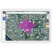
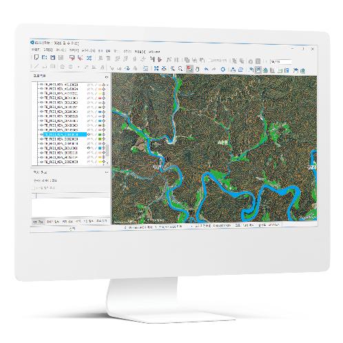
Specialized GIS tool for forest management
-
Features
Intuitive and easy UI
-
Condition
Software
PRODUCT DESCRIPTION
IGIS-Forest
IGIS is a specialized forest GIS solution to enable editing, analyzing, and 3D modeling of forest geospatial info by building up optimized system for forestry work.
- Basic Functions
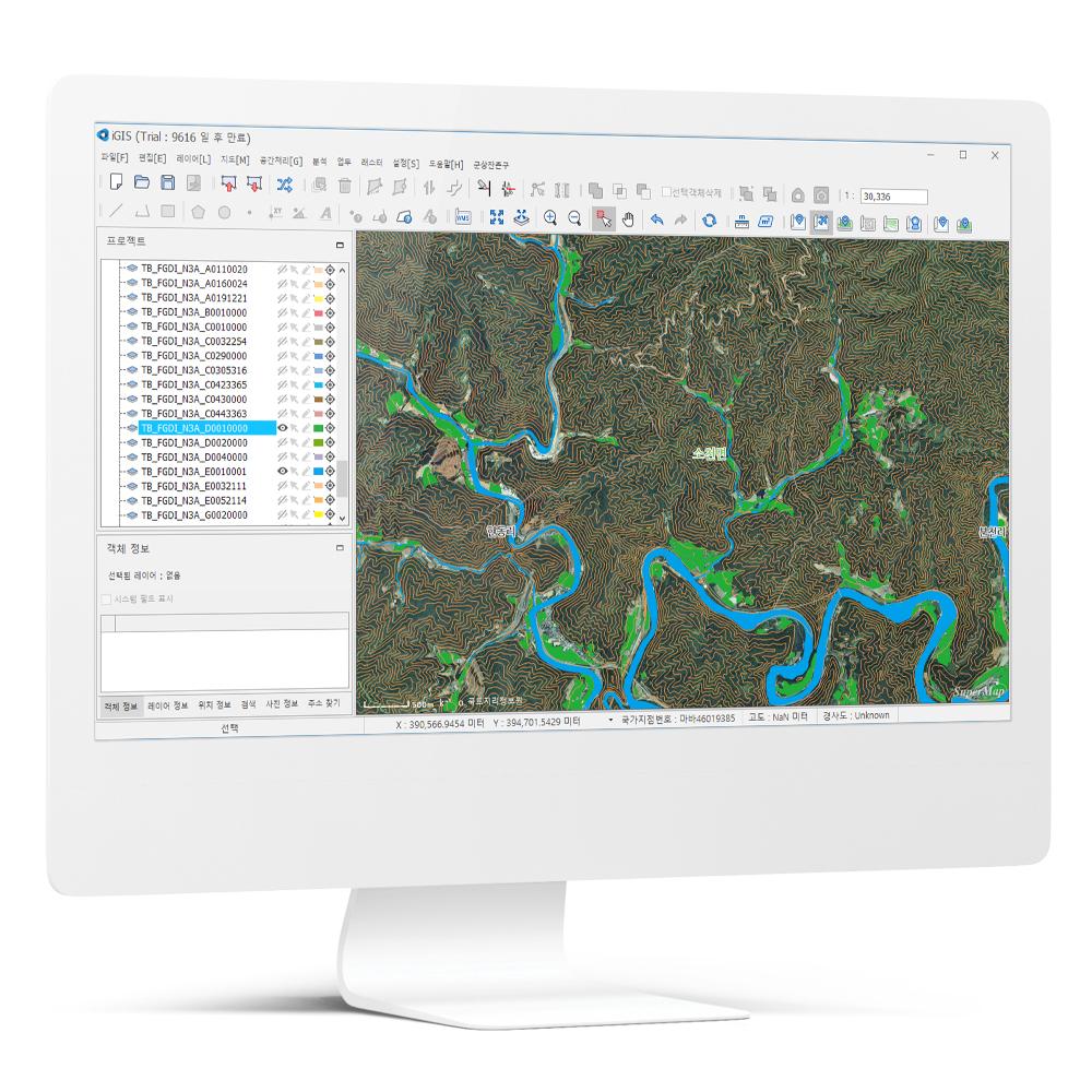
It can edit basic history functions and properties of geospatial data using functions for general-purpose of IGIS as well as necessary functions for forestry-related work.
It can edit basic history functions and properties of geospatial data using functions for general-purpose of IGIS as well as necessary functions for forestry-related work.
- Analysis Functions Supported
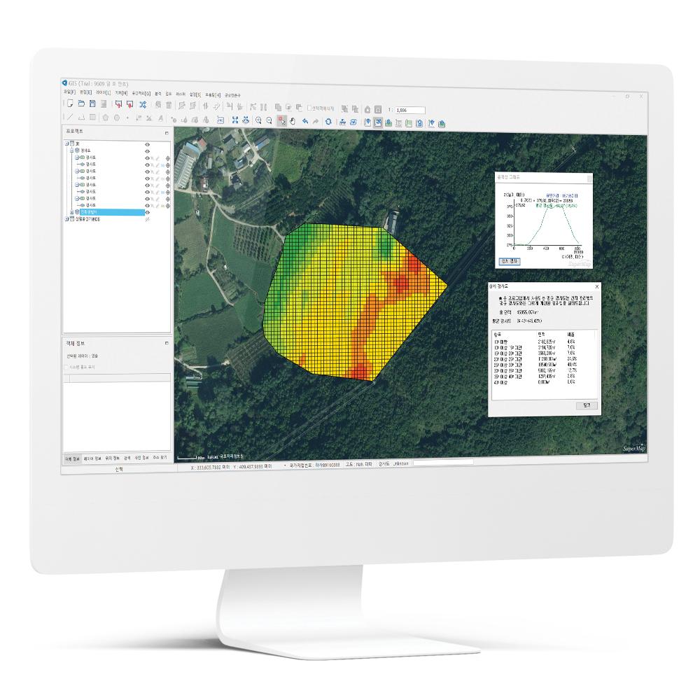
It supports 3D measurement (surface distance/area, volume, slope) using DEM (Digital Elevation Model) and provides necessary analysis functions for forestry work, such as visibility range, gradient, and water flow analysis.
It supports 3D measurement (surface distance/area, volume, slope) using DEM (Digital Elevation Model) and provides necessary analysis functions for forestry work, such as visibility range, gradient, and water flow analysis.
- Eco-friendly Logging Design Function
Creating skidding roads and forest belts for eco-friendly logging is supported, while it can generate reports automatically through group planning and impact area analysis for logging areas.
Creating skidding roads and forest belts for eco-friendly logging is supported, while it can generate reports automatically through group planning and impact area analysis for logging areas.
- Task-Related Functions Provided
Users can easily create necessary data for tasks, such as joining country branch codes, extracting cadastral info of planned forest trails, converting between PNU(Parcel Number) and address, and exporting geospatial data after buffering or joining Excel.
Users can easily create necessary data for tasks, such as joining country branch codes, extracting cadastral info of planned forest trails, converting between PNU(Parcel Number) and address, and exporting geospatial data after buffering or joining Excel.
- Skidding Road Design Functions Provided
Suppose there is a line to use as a skidding trail. In that case, users can quickly and automatically create measuring points, vertical/ transverse alignments, longitudinal/cross-sectional views, survey field notes, etc., to apply them to the designs of skidding trails.
Suppose there is a line to use as a skidding trail. In that case, users can quickly and automatically create measuring points, vertical/ transverse alignments, longitudinal/cross-sectional views, survey field notes, etc., to apply them to the designs of skidding trails.
PAYMENTS DETAILS
This supplier supports payments for offline orders
- WK
- Telegraphic Transfer : T/T
- Name : Nahee Yu
SHIPPING
Shipping from :
Republic of Korea
- 232 Alphacity 1-ro, Suseong-gu, Daegu (42250)
IGIS Co., Ltd.
The person in charge
Ho-Dong LeeAddress
232 Alphacity 1-ro, Suseong-gu, Daegu (42250)
IGIS
IGIS Co., Ltd.
Introduction
IGIS is an ICT solution company specialized in developing geographic information systems and geospatial data-based drone solutions. We satisfy our customers' needs in various industries with our solutions such as IGIS, a geographic information system, DFOS, a drone integration solution that encompasses drone flight, control and data management, and FMS, a specialized system for field management.
In the public sectors, our solutions are being applied to the systems of Korea Forest Service, Korea Forestry Promotion Institute (KOFPI), Seongju County and etc. In the private sector, we provide a software platform with a domestic large company for their hydrogen fuel cells-powered drones. With our own wealth of knowledge and practical experience, we are willing to support our partners in a variety of fields including construction, civil engineering, and so on.
-
- Business Type :
- Other
-
- Main Product :
- Drone Software, GIS
-
- Established :
- 2018-02-07
-
- Total Annual Revenue :
- 1~2 billion (KRW)
-
- Total Employees :
- 11~50 people
Please suggest a variety of your ideas such as design, impact, enhancements, etc
Captcha Required
Please enter the text on the left image to prevent automatic input.
0 / 4000
질문이 없습니다.
CUSTOMER REVIEWS (0)

TRADE EXPERIENCE
-
- Total revenue
- 1~2 billion (KRW)
-
- Total export revenue (previous year in USD)
- 0
-
- Number of foreign trade employees
- 11~50 people
COMPARISON TO SIMILAR ITEMS more
- No Items
- supplier level
- MEMBER
- IGIS Co., Ltd.
- Seller's Store url
- Response Level
★ ★ ★ ★ ★

- Supplier Level
★ ★ ★ ★ ★
- Transaction Level
★ ★ ★ ★ ★
SUPPLIER BEST