


ITEM SPECIFICS
-
Brand
Model IGIS-DFOS Panorama PlatformDFOS
-
origin
Republic of Korea
-
Size(Capacity)
Application
-
Function
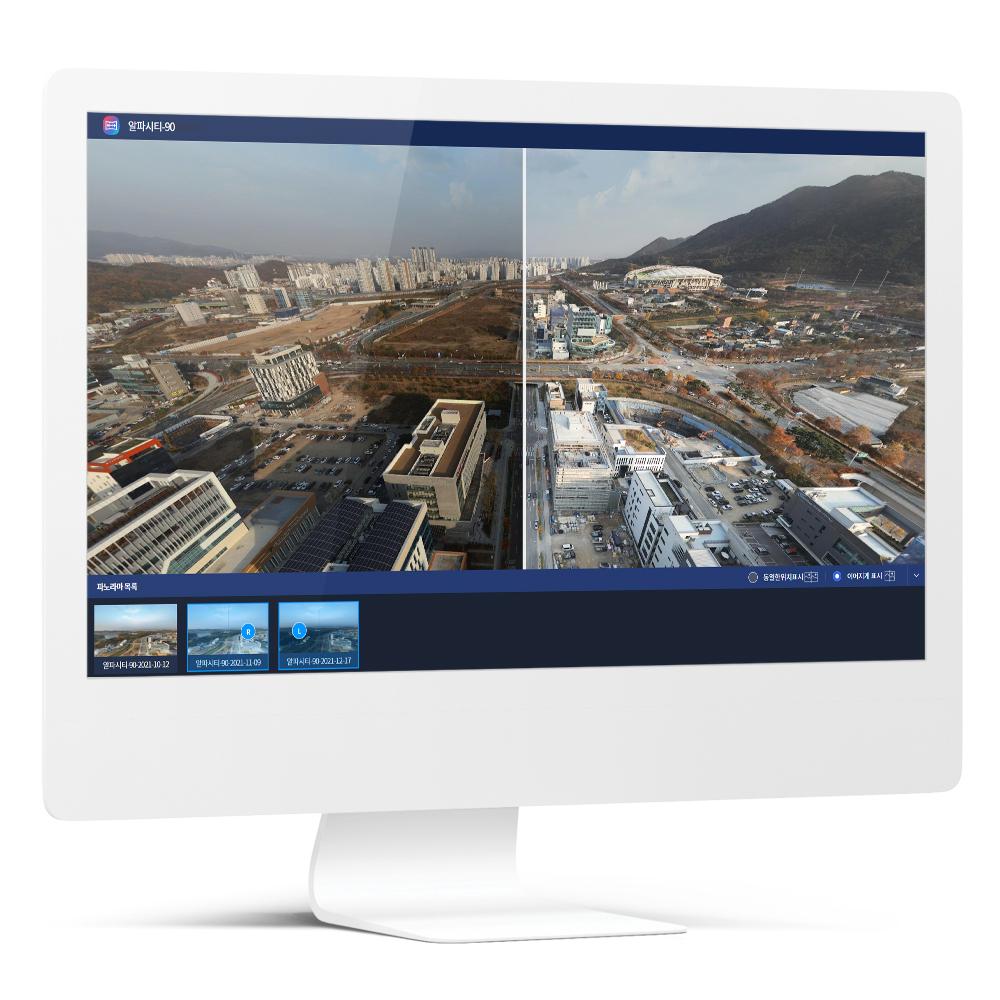
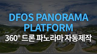
360-degree panorama production
-
Features
Easy creation and utilization of panoramic image
-
Condition
Software
PRODUCT DESCRIPTION
IGIS-DFOS Panorama Platform
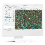
DFOS Panorama Platform is a panoramic web service that converts the photos taken by multiple drones & cameras into a 360-degree panorama to be viewed with geospatial data (e.g. cadastral maps, etc.).
- Easy Creation of Panoramic Image
General cameras, not dedicated panoramic cameras, can be applied to the system that produces panoramic images to increase the usability of the drone and reduce the cost of additional equipment.
General cameras, not dedicated panoramic cameras, can be applied to the system that produces panoramic images to increase the usability of the drone and reduce the cost of additional equipment.
- Convenient Panoramic Image Management
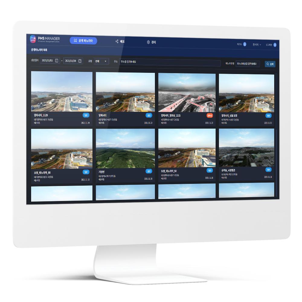
The progress of the panorama video production can be checked in real time, and the completed videos can be viewed and distributed conveniently.
The progress of the panorama video production can be checked in real time, and the completed videos can be viewed and distributed conveniently.
- Utilization of Geospatial Data
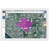
Location info can be applied to the image taken by drones so that various geospatial info can be displayed as multiple x-layers on the panoramic image. Both new and existing geospatial data can be utilized.
Location info can be applied to the image taken by drones so that various geospatial info can be displayed as multiple x-layers on the panoramic image. Both new and existing geospatial data can be utilized.
- Various Devices Supported
Both web and mobile modes are supported, and various devices such as PC, smartphone, and tablet can be used to enjoy the service conveniently.
Both web and mobile modes are supported, and various devices such as PC, smartphone, and tablet can be used to enjoy the service conveniently.
- Diverse Convenient Functions Provided
The shooting place of panoramic image can be marked on the map as a location system while multiple videos can be checked conveniently.
The shooting place of panoramic image can be marked on the map as a location system while multiple videos can be checked conveniently.
PAYMENTS DETAILS
This supplier supports payments for offline orders
- WK
- Telegraphic Transfer : T/T
- Name : Nahee Yu
SHIPPING
Shipping from :
Republic of Korea
- 232 Alphacity 1-ro, Suseong-gu, Daegu (42250)
IGIS Co., Ltd.
The person in charge
Ho-Dong LeeAddress
232 Alphacity 1-ro, Suseong-gu, Daegu (42250)
IGIS
IGIS Co., Ltd.
Introduction
IGIS is an ICT solution company specialized in developing geographic information systems and geospatial data-based drone solutions. We satisfy our customers' needs in various industries with our solutions such as IGIS, a geographic information system, DFOS, a drone integration solution that encompasses drone flight, control and data management, and FMS, a specialized system for field management.
In the public sectors, our solutions are being applied to the systems of Korea Forest Service, Korea Forestry Promotion Institute (KOFPI), Seongju County and etc. In the private sector, we provide a software platform with a domestic large company for their hydrogen fuel cells-powered drones. With our own wealth of knowledge and practical experience, we are willing to support our partners in a variety of fields including construction, civil engineering, and so on.
-
- Business Type :
- Other
-
- Main Product :
- Drone Software, GIS
-
- Established :
- 2018-02-07
-
- Total Annual Revenue :
- 1~2 billion (KRW)
-
- Total Employees :
- 11~50 people
Please suggest a variety of your ideas such as design, impact, enhancements, etc
Captcha Required
Please enter the text on the left image to prevent automatic input.
0 / 4000
질문이 없습니다.
CUSTOMER REVIEWS (0)

TRADE EXPERIENCE
-
- Total revenue
- 1~2 billion (KRW)
-
- Total export revenue (previous year in USD)
- 0
-
- Number of foreign trade employees
- 11~50 people
COMPARISON TO SIMILAR ITEMS more
- No Items
- supplier level
- MEMBER
- IGIS Co., Ltd.
- Seller's Store url
- Response Level
★ ★ ★ ★ ★

- Supplier Level
★ ★ ★ ★ ★
- Transaction Level
★ ★ ★ ★ ★
SUPPLIER BEST